Arvaikheer (Arvayheer)
Arvaikheer, also spelt Arwaiheer (Арвайхээр, ; "Barley Steppe") is the capital of Övörkhangai Aimag (province) and one of the most central points of Mongolia.
It is a centre for traditional crafts, goat herding and equestrian sports, and hosts a large regional horse festival every year. Arvaikheer has a population of 19,058 (2000 census), 23,298 (2004 est.), 24,954 (2006 est.), 25,622 (2008 est. ). Arvaikheer is by far the largest town in the aimag.
Arvaikheer has a cold semi-arid climate (Köppen climate classification BSk) with mild summers and relatively mild winters by Mongolian standards. The 30 degrees Celsius difference between average January and average July temperature makes it the mildest place in Mongolia, along with Tsetserleg in Arkhangai Province. It is located in a microclimate in the center of Mongolia which sees less harsh winters than the rest of the country. Its 1813 m elevation at the foot of the eastern hills of the Khangai Mountains augments its mildness by keeping it distant from cold air pools in low basins. Most precipitation falls in the summer as rain, with some snow in March, April and October. Winters are very dry.
Map - Arvaikheer (Arvayheer)
Map
Country - Mongolia
 |
|
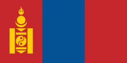
| Flag of Mongolia | |
The territory of modern-day Mongolia has been ruled by various nomadic empires, including the Xiongnu, the Xianbei, the Rouran, the First Turkic Khaganate, and others. In 1206, Genghis Khan founded the Mongol Empire, which became the largest contiguous land empire in history. His grandson Kublai Khan conquered China proper and established the Yuan dynasty. After the collapse of the Yuan, the Mongols retreated to Mongolia and resumed their earlier pattern of factional conflict, except during the era of Dayan Khan and Tumen Zasagt Khan. In the 16th century, Tibetan Buddhism spread to Mongolia, being further led by the Manchu-founded Qing dynasty, which absorbed the country in the 17th century. By the early 20th century, almost one-third of the adult male population were Buddhist monks. After the collapse of the Qing dynasty in 1911, Mongolia declared independence, and achieved actual independence from the Republic of China in 1921. Shortly thereafter, the country became a satellite state of the Soviet Union, which had aided its independence from China. In 1924, the Mongolian People's Republic was founded as a socialist state. After the anti-communist revolutions of 1989, Mongolia conducted its own peaceful democratic revolution in early 1990. This led to a multi-party system, a new constitution of 1992, and transition to a market economy.
Currency / Language
| ISO | Currency | Symbol | Significant figures |
|---|---|---|---|
| MNT | Mongolian tögrög | ₮ | 2 |
| ISO | Language |
|---|---|
| MN | Mongolian language |
| RU | Russian language |


